
Belton Neighbors: Block Sources
A block-level Belton neighbors search starts with a geographic question: which parcels touch or sit near the target parcel? County GIS can show parcel geometry, roads, and layers. Bell CAD supplies one public parcel card at a time. The City boundary service checks whether the setting is within city limits, an ETJ, or another mapped jurisdiction. None of those sources establishes a complete household. A voter or organization source has its own rules and should be used only for the limited purpose it documents.
| Block source | What it shows about a block | Access and limit |
|---|---|---|
| Bell County GIS | Adjacent parcel geometry, roads, and county map context | Public web map; available fields differ by layer. |
| City boundary service | City limits, neighboring cities, ETJ, Fort Hood, and TIRZ context | Public ArcGIS service; no resident or occupancy fields. |
| Bell CAD | Individual parcel cards, subdivision labels, owner fields, and mailing fields | Public search; each card reflects a parcel record, not a household list. |
| Texas voter-file route | Address and precinct elements when lawfully released | Restricted request and affidavit; not a casual public block roster. |
| HOA certificate search | Association and management-certificate organization names | Public county, city, ZIP, and association-type filters; no member list. |
| Chamber and civic pages | Public organizations, business contacts, programs, and events | Organization sources; no complete local household layer. |
An owner field may document a tax-roll or recorded relationship, while a mailing field may be a PO Box, agent, entity, or address elsewhere. Treat “adjacent parcel” as the defensible term unless a second record independently supports a more specific connection.
Belton Neighbor Parcel Identifiers
One Bell CAD parcel card can carry several useful identifiers. Property ID and geographic ID link the tax-roll record to map context. A map ID helps return to a mapped location. The legal description may carry the abstract, lot, block, or acreage language that can outlast a visible street-label change. The card can also display situs, mailing address, owner ID and name, agent, property type, tax year, values, ownership percentage, a land table, and exemption indicators.
Those fields should not be merged into a personal profile. A Belton situs tells where the appraisal district places the parcel. A mailing field tells where correspondence is directed. A homestead indicator can be consistent with owner occupancy but is not conclusive. Bell CAD states that some categories, including personal, mineral, mobile-home, or unmapped properties, may be absent from its map view. Map absence alone is not proof that a parcel or record is absent.
Note: Preserve the property ID, geographic ID, map ID, tax year, and retrieval date before comparing neighboring Belton parcels.
Mapping Belton Neighbor Parcels
The adjacent-parcel method is a reproducible way to study the block around one address. It begins with an exact parcel identifier, not a name. The Bell County ArcGIS web map provides county map context, while the City service provides jurisdiction layers. Return to Bell CAD for the public card of each selected parcel. A popup is map evidence, not a deed or evidence of occupancy.
- Find the target parcel by its CAD property ID, geographic ID, or a verified address.
- Open the county map, select a parcel or boundary layer, zoom to the feature, and record the layer name and map extent.
- Click surrounding features one at a time and save only the parcel or map identifiers needed to revisit each public card.
- Open the matching CAD card and compare its legal description, subdivision or neighborhood label, situs, and tax year with the mapped feature.
- Use the City boundary layers for an incorporated-city, ETJ, neighboring-city, Fort Hood, or TIRZ question. Keep that result separate from a parcel relationship.
For a complete named-street record trail, the Belton street directory follows the CAD, deed, and historical-source sequence. This block method stays focused on nearby parcel context and does not turn adjacent map features into a household roster.
Belton Neighbor Voter Displays
VoteTexas directs an individual to the state “Am I Registered?” lookup. The state describes VUID, Texas driver-license information when supplied, or first and last name as search paths. A match concerns registration status and election information, not a downloadable block list. A non-match can reflect spelling, a recent move, county transfer, confidentiality, cancellation, a missing identifier, or an interface limitation. Suspense is an address-confirmation issue, not a simple declaration that a voter is ineligible.
The Secretary of State's bulk-file route is different. It requires a physical requestor address, affidavit, payment or deposit, and a permitted use. The file layout can include address components and precinct or election fields, but protected SSN, driver-license, PID, source, and full date-of-birth information is not for public display. The affidavit bars advertising or promotional use. Bell County Elections publishes 254-933-5774, Elections@BellCounty.Texas.gov, and Voter.Registration@BellCounty.Texas.gov for registration, list-maintenance, confidentiality, or county-request questions.
Suppression requests, confidential voter displays, and the Texas Address Confidentiality Program can mean that an ordinary public display omits an address or uses a substitute address. Do not treat a missing nearby address as proof that no one is registered there, and do not try to reconstruct a protected residence.
Belton Neighbor HOA Certificates
The official Texas HOA management-certificate search is an organization-level resource. Its filters include association, county, city, ZIP, and association type. The Bell County results inspected for this research included West Canyon Trails Residential Community, Inc., Belton Legend Oaks Property Owners Association, and River Farm Residential Community. A certificate can identify an organization, a management or legal contact, and a document date. It does not disclose a member roster, household identity, or occupancy.
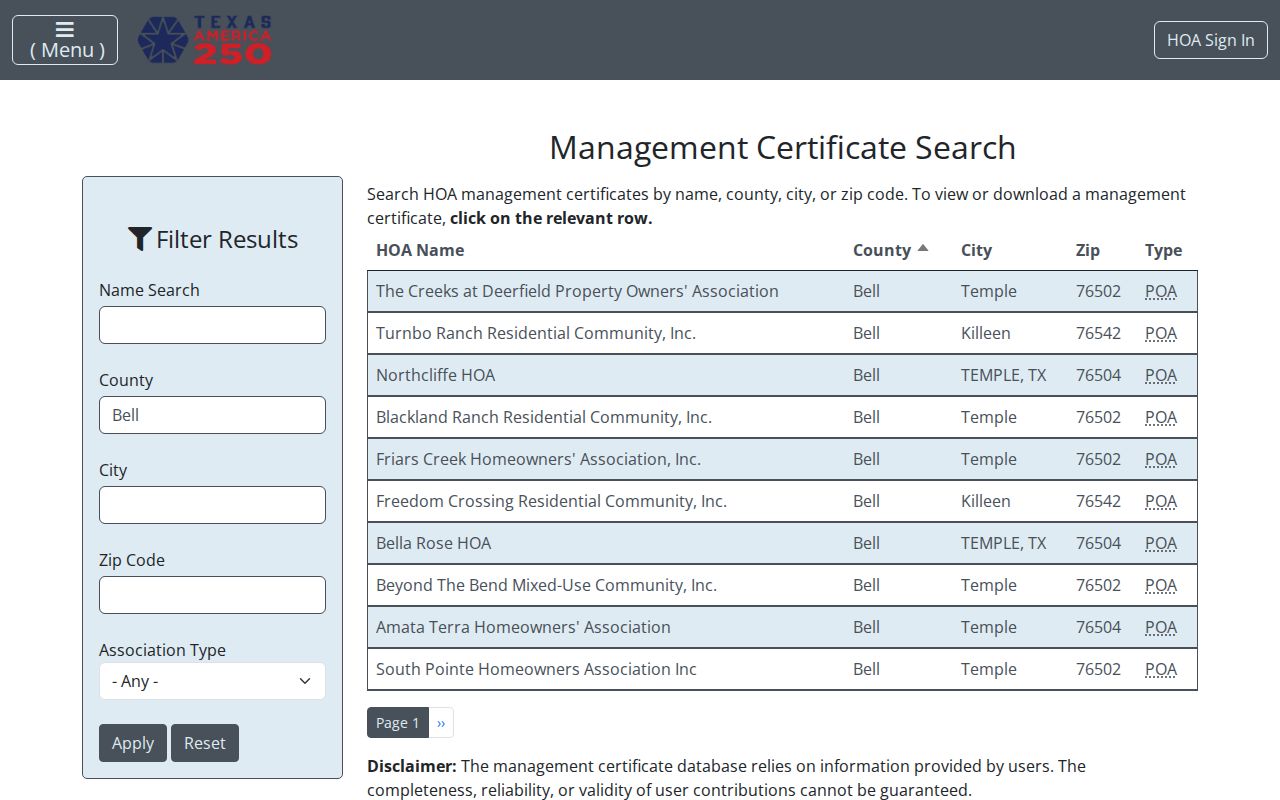
The certificate search is strongest when paired with a CAD subdivision or neighborhood label and a GIS boundary check. Even then, do not assume every parcel in a subdivision is covered, that a certificate describes an earlier period, or that a listed manager lives nearby.
| Organization source | Published result | It cannot establish |
|---|---|---|
| Texas HOA certificates | Association, county, city, ZIP, certificate, and organization-level contact | Members, household composition, or current occupancy. |
| CAD subdivision or neighborhood | Parcel and mapped subdivision context | Association membership or a complete community roster. |
| GIS boundary layers | Geographic context and adjacent features | Whether an association includes every visible parcel. |
Belton Civic Contacts
The community-directory layer is about public organizations, not a social graph. City and library navigation identify the Downtown Belton Business Alliance, Friends of the Belton Public Library, Citizens Helping in Police Service, Belton CERT, Kiwanis, Lions, Rotary, and the Chamber. Public board, event, newsletter, or program material may establish a dated public role. It does not establish where a participant lives or prove current membership.
The Belton Chamber directory supports keyword and category searching for organizations and businesses. At inspection, it reported 655 results. The Chamber publishes 412 E Central Avenue, Belton, a PO Box 659 mailing address, and 254-939-3551 as public contact information, as well as Leadership Belton and military-relations or community programs.
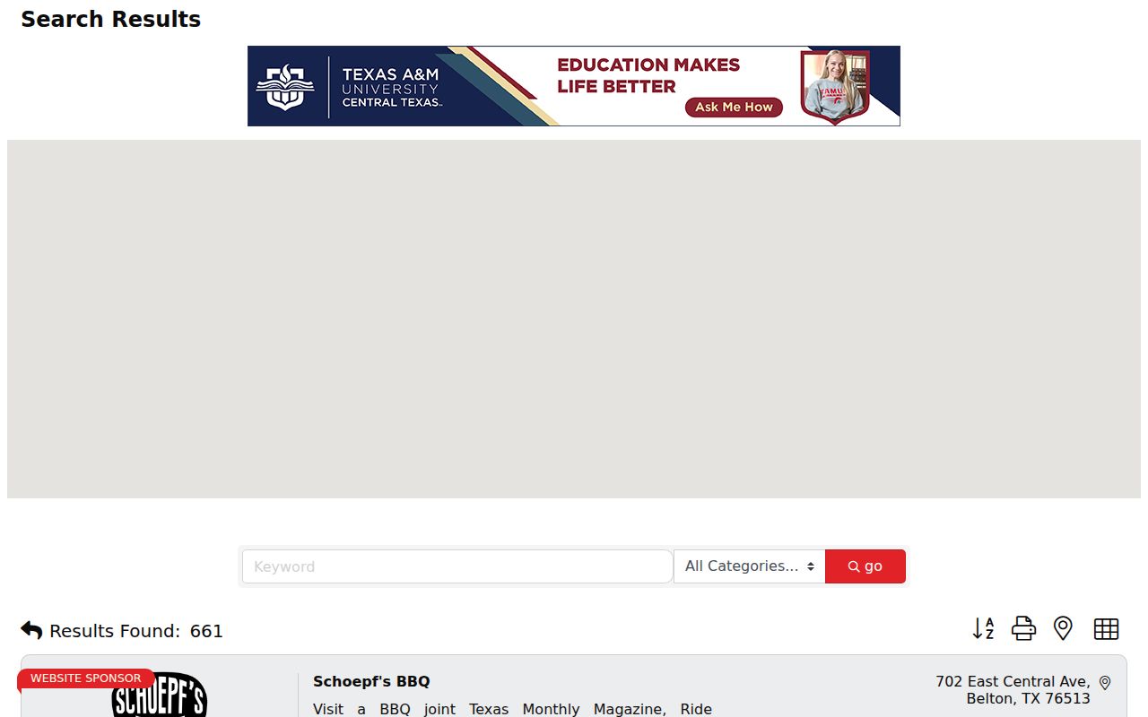
That directory is appropriate for identifying a public organization or business contact. It should not be read as a neighborhood-resident record or as proof that a person at a listed business is associated with a nearby parcel.
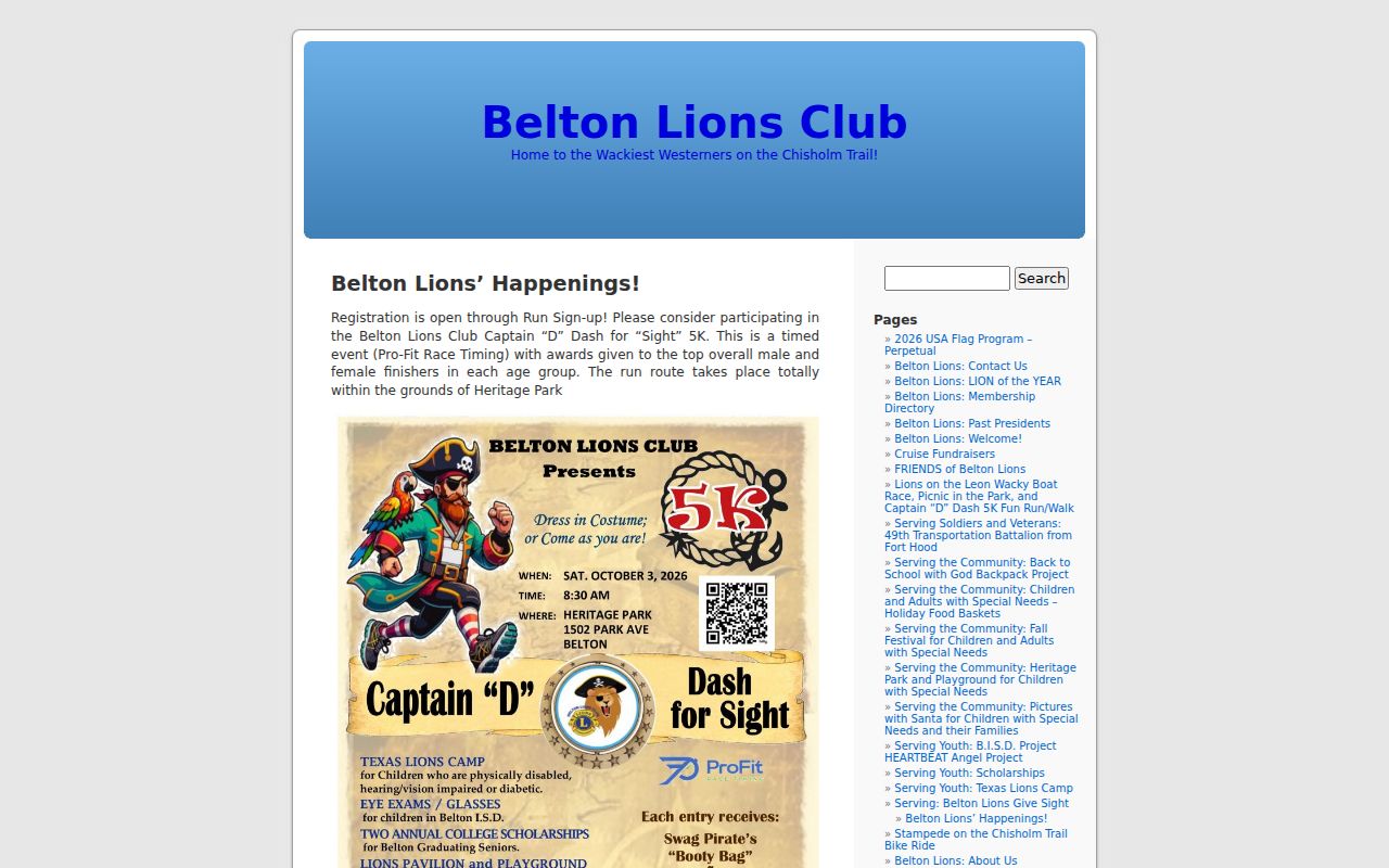
The Belton Lions Club describes charitable and educational work, scholarships, a special-needs playground, and Heritage Park events. It is a useful civic-history and event-contact source, but research found no public membership roster.
Friends of the Belton Public Library, the Museum Research Library, and the Bell County Genealogical Society can also provide local-history leads. Ask each repository or organization about a specific collection or event instead of inferring a personal connection from a public organization page.
Belton Neighbor Tools Compared
Official parcel and map sources document a bounded record relationship. Commercial neighbor-lookup tools are a different category. They may combine older addresses, public filings, marketing signals, public websites, and inferred relationships. Their coverage, correction path, cost, deletion practice, and update timing vary. A stale or same-name match should never replace the CAD, GIS, or Clerk source that actually supports the question.
| Source category | Best use | Key limit |
|---|---|---|
| Official CAD and GIS | Parcel, legal-description, mapped-adjacency, and boundary questions | Does not establish every occupant or private contact detail. |
| Recorded instruments | Dated parties and property-interest events | Recorded role is not a household statement. |
| Commercial neighbor tools | Unverified lead requiring source checks | May be stale, conflate common names, or infer relationships. |
Use a second matching identifier, such as a parcel ID, legal-description connection, middle initial, case number, public organization role, or dated historical context before treating a same-name result as a lead worth pursuing.
Belton Neighbor Boundary Context
Belton is both a city and the Bell County seat, so county courthouse and municipal research routes operate in a compact local geography. Yet a Belton mailing label is not a city-limit determination. CAD provides situs and mailing fields, the county map supplies parcel and road context, and the City Admin Boundaries FeatureServer distinguishes City Limits, Neighboring Cities, ETJ, TIRZ, and related layers. USPS delivery information answers a different question.
Boundary timing matters as well. The Comprehensive Plan's annexation history includes ordinance references and a 2011 disannexation notation. A current city layer cannot be projected backward to describe an older block. When an address or street label looks inconsistent, retain the map date, ordinance or plan reference, lot or block, subdivision, map ID, and source wording. No official master list of Belton address renumberings was located.
Note: Label each result as parcel geography, mailing address, or incorporated boundary instead of silently treating them as the same fact.
Belton Neighbor Privacy Limits
Texas public access begins with the Texas Public Information Act, a request-and-exception framework for existing records. It does not create a neighborhood directory. Household members not named in a public record, non-owner occupants, utility and delivery data, protected voter information, victim-protection addresses, DMV address data, and sealed or restricted court or vital material stay outside a public block search. The Driver's Privacy Protection Act also limits motor-vehicle personal information.
For a City record that is not indexed, submit a defined request through the Belton JustFOIA portal. Identify the department, date range, record type, relevant address, and desired electronic format. Ask for segregable public portions and the statutory exception supporting any redaction. A request should seek records the City keeps, not demand that it create a new neighborhood list.
Lawful use. Belton neighbor research can support property curiosity, local history, civic questions, and reconnection through lawful sources. Do not use it to stalk, harass, intimidate, or harm anyone, and never triangulate a protected address.