
Belton Previous Residents by Era
Previous residents research works best when each source is assigned its own job. A deed connects parties to a recorded property event. A directory, if a verified local volume is located, may connect a printed address to a listed householder or business. A census schedule captures a household on its enumeration date. Maps establish a block, building footprint, or lot context. None of these sources alone proves an uninterrupted occupancy history. The years below are the historical coverage actually documented in the Belton research, not a claim that every item is digitized or searchable online.
| Source | Years It Covers | Where Held | What It Shows |
|---|---|---|---|
| Bell County deed records | 1850-1902 in the TSLAC guide; overlapping index reels cover 1850-1900 periods | Baylor microfilm, county books, and later Clerk portal access | Grantor, grantee, instrument, legal description, and recording event. |
| Bell County death records and index | Records 1903-1937; index to 1989 | TSLAC guide, microfilm, and state or county routes | A dated death and name lead, subject to access rules. |
| Bell County marriage records | 1850-1935 | TSLAC or Baylor route and county or state records | A marriage event and named parties, not an address history by itself. |
| City directories | Exact Belton run not located | Library, TSLAC, UT, and UNT catalogue verification | Possible alphabetical or street address-to-householder entries if a volume is found. |
| Sanborn maps | Coverage listed 1885-1949; inspected 1907 and 1921 examples | UT Briscoe, UNT, and Library of Congress tools | Building footprint, use, lot or block, streets, and fire-related details. |
| Federal census | Public through the 1950 census under the 72-year rule | National Archives and approved digitized services | A dated household enumeration and its recorded geography. |
| Newspaper archive | Uneven local issues from 1877-1918 plus later archive access | UNT, Belton Newspaper Archive, and Belton Journal | Notices, obituaries, events, businesses, and local wording. |
For a recent transaction, the online Bell County index is a logical opening. The public landing page did not state a first online year or an historical cutoff. For early deeds, the published fallback is the TSLAC guide and its microfilm route. That distinction prevents an online blank from becoming a false claim that the record does not exist.
Belton Previous Residents Need Stable Keys
Begin with the oldest reliable identifier available, not a guessed name. The Bell Central Appraisal District search can be searched by address, owner, property ID, geographic ID, subdivision, neighborhood, tax year, and other fields. A parcel card may show a situs address, mailing address, legal description, map ID, property ID, geographic ID, values, and an owner name for appraisal purposes. Copy the legal-description phrase and identifiers exactly. They often survive a changed street spelling or number better than a modern street string.
Situs is the place identified for the parcel. Mailing is where tax correspondence goes. A PO Box, an agent, a trust or company address, or a different city in the mailing field does not establish where a person lived. The CAD card is a parcel and tax record, not a household roster. Bell County GIS is useful to see geometry and administrative boundaries, but its popup is the map side of the trail rather than proof of ownership or occupancy.
The Bell County ArcGIS map can be checked alongside the CAD card when a lot, boundary, or parcel geometry must be matched.
Note: Keep the retrieval date with every CAD and GIS observation because current data and mapped parcels can change.
Tracing Belton Previous Residents Through Deeds
The Bell County Clerk holds real-property instruments, plats, probate records, and related county series. Its Official Records Search supports quick and advanced searches using grantor or grantee, document number, subdivision, document type, date range, and index-only or OCR options. The portal was inspected on September 1, 2026, when it displayed a certification line through August 31, 2026. That statement concerns current access at inspection, not the first year of electronic images or a complete historical online range.
- Pull the current parcel’s legal description and identifiers from Bell CAD, then save the exact wording and retrieval date.
- Search the Clerk index for the current purchaser as grantee, using the legal description, lot or block, subdivision, date, and document type to narrow common names.
- Read the resulting instrument and identify the seller or grantor. Record the document number, recorded date, party roles, and legal description separately.
- Search that earlier party as a prior grantee, then repeat backward through deeds, releases, corrections, plats, probate, estate, or entity records.
- When the online route stops producing a documented result, move to the TSLAC guide, Baylor microfilm, county books, or a Clerk inquiry rather than guessing an online cutoff.
- Grantor
- The person or entity conveying an interest in a recorded instrument.
- Grantee
- The person or entity receiving that interest. These roles are not the same as an occupancy finding.
- Chain of title
- A dated sequence of recorded instruments affecting a parcel or interest.
- Legal description
- The lot, block, subdivision, abstract, or metes-and-bounds wording used to identify land in records. It is often more durable than a street address.
A release may resolve a security instrument without changing ownership. An attorney-in-fact, lender, trustee, spouse, estate, corporation, or beneficiary may appear in a record. Preserve the exact role before connecting it to an address history.
Belton Previous Residents Before Digital Records
The Texas State Library Bell County local-records guide is the published coverage map for early work. It lists deed books from 1850 through 1902, historical deed indexes, marriage records from 1850 through 1935, death records beginning in 1903, and delayed-birth and commissioners-court material. The guide points to Baylor microfilm and some FamilySearch digitization. Viewing, copying, and reproduction rules should be confirmed with TSLAC or the holding library before a visit.
The TSLAC Bell County guide identifies the microfilm and reel coverage that supports early address research.
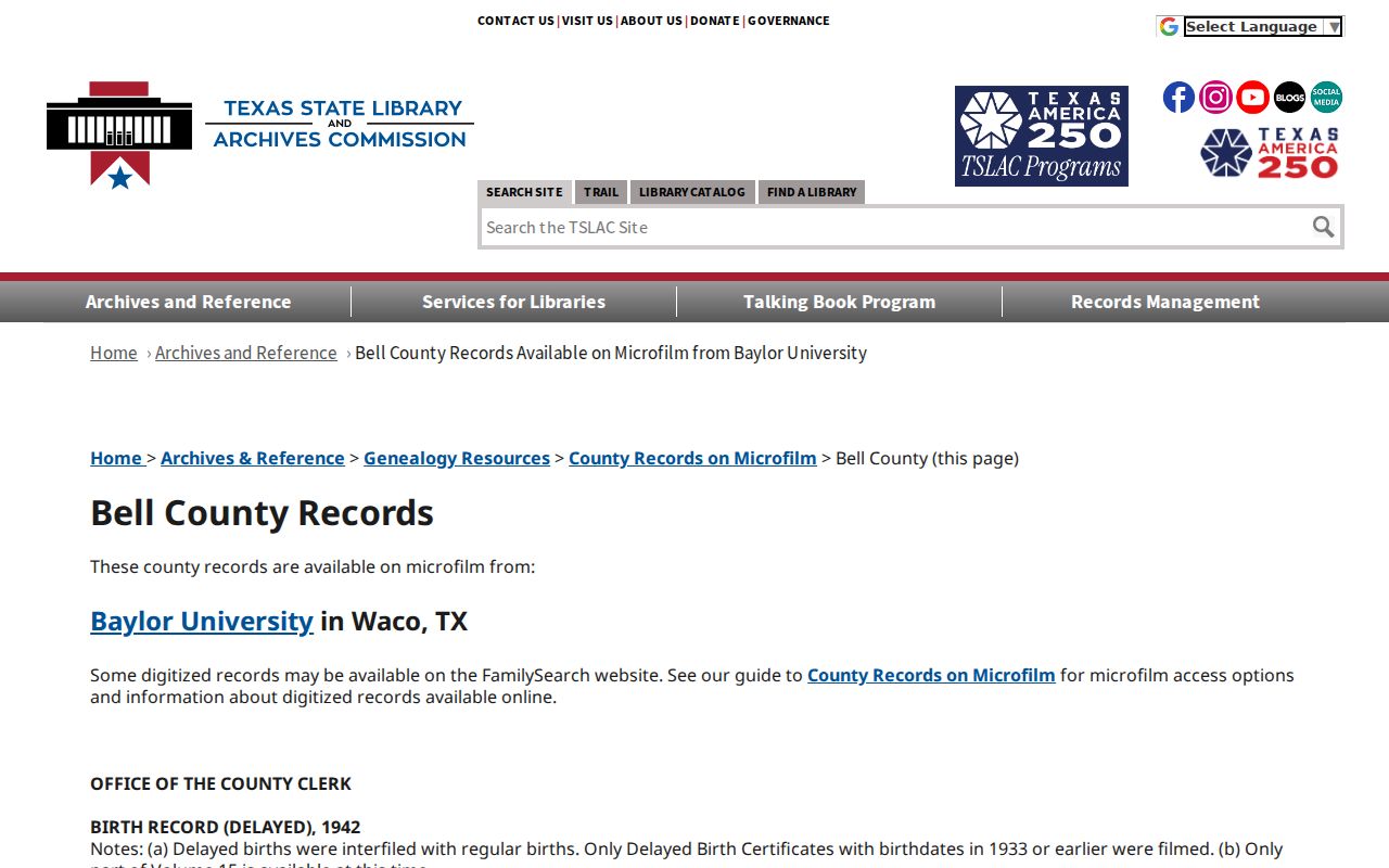
Use the guide’s reel and record-set details to request a specific record family, date window, and name rather than an open-ended request.
Probate can supply an estate connection or an endpoint to a chain. The Bell County Probate Record Search Form asks for the decedent’s name, date of death, case number, requestor contact information, document type, signature, and date; it offers a field for probate filed before 1988. The form lists a $5 search per name, $1 per page copy, $1 per-document certification, and a card convenience fee for a stated payment range. Confirm current charges before sending payment.
House-history support is distributed. Belton Public Library offers local-history and newspaper leads, while the Bell County Museum Research Library provides in-house family, cemetery, map, and local-history material at 201 N Main in Belton. The Museum publishes 254-933-5243 and museum@bellcounty.texas.gov. Ask for a former street name, lot or block, likely decade, and whether copies are permitted. The Bell County Genealogical Society can also help interpret local family and place-name conventions.
Belton Previous Residents in Directories
Ownership is only one layer of a past-address question. A verified city or reverse directory can sometimes place a listed householder or business at a printed address, while the census can place a household within its dated enumeration geography. No Belton-specific city-directory run, publisher, shelf mark, or criss-cross series was located in the inspected sources. Do not insert a city-directory year because it resembles a nearby city’s pattern. Check the library, TSLAC, UT Briscoe, UNT, and Bell County Museum for an actual title first.
When a volume is confirmed, record its title, publisher, year, geographic scope, repository, call number or item URL, digitization status, and entry page. Compare an alphabetical entry with a street listing if that particular volume contains both. An address may be a business, office, boarding-house, or delivery convention. A directory omission may reflect a move, death, spelling variant, publication gap, or coverage decision. The historical directory collections themselves are described on the Belton city directory page.
- Match the verified directory year to the nearest public census year and write down the place named by each source.
- Compare surname, initials, married or maiden names, alternate spacing such as Mc or Mac, and any printed address.
- Use a newspaper, deed, map, cemetery, or vital index to test a difference instead of forcing two names to match.
- Label the result exact match, probable match, unresolved same-name match, or source gap.
The census is public through 1950 under the 72-year rule. It is a dated enumeration, not a full annual sequence. Census place, city limits, postal delivery, and modern parcel geography can differ, particularly in a place with city, county-seat, ETJ, and regional descriptions.
Belton Previous Residents in Newspapers
The Belton newspaper trail adds dates and local wording that a deed cannot supply. UNT’s Belton Public Library partner page reports materials from the 1840s through the 1960s, including local newspapers and photographs. The documented runs are uneven: Belton Journal material from September 23, 1880, to August 8, 1918, Belton Weekly Journal from 1877 to 1882, sparse Belton Reporter issues, plus other local titles. A social item, advertisement, obituary, court notice, or civic report is a dated observation. It is not automatically proof that a named person occupied an address.
The Belton Journal archive is a current route for searching later local material and checking issue dates.
Record the newspaper title, issue date, page, article URL, and whether the item is an advertisement, legal notice, or editorial text before using it in a timeline.
For block context, UT Briscoe’s 1907 Belton Sanborn sheet records buildings, construction, commercial occupancy, boundaries, house and block numbers, and fire and water details. The 1921 sheet offers a second checkpoint. TxDOT lists Belton Sanborn coverage from 1885 to 1949, but the range is not a promise of complete online sheets. Maps show the built environment, not all people who used a building.
Belton Previous Residents and Changed Streets
A current address can hide an older lot or block identity. Belton’s historic walking-tour material describes early blocks, streets, and lots around the courthouse, while the city’s Comprehensive Plan includes an annexation-history map with ordinance references. The sources document annexation context and a street-renaming policy, but no complete renumbering timeline or master list of Belton renamings was located. Do not backdate a current city limit or assume that a modern number appeared in every decade.
The 1879 central-district fire and later rebuilding provide another useful distinction: a lot may retain continuity while the building or business changes. Compare an old legal description, subdivision, lot or block, abstract, map sheet, dated newspaper wording, and the applicable ordinance or map. The most defensible question may be whether records point to the same lot or the same building, rather than assuming either answer from a street name alone.
Note: A map label, historic structure, or modern postal line is context for an address trail, not a complete record of who lived there.
Belton Previous Residents Research Limits
Use an address trail for family history, estate and heir research, property history, or personal civic curiosity. Keep only the details needed to document a dated match. Texas public-information access under Government Code Chapter 552 is subject to exceptions and record-specific confidentiality rules. A city request should identify the department, record type, address or instrument number, date range, and desired format. Belton’s JustFOIA portal is the municipal route for a defined city record request.
Do not attempt to reconstruct a protected address. Voter suppression, the Texas Address Confidentiality Program, restricted vital records, sealed materials, and driver-record privacy all place boundaries around what a public display may show. An owner listed on a CAD card, a party named in a deed, and a person mentioned in a newspaper each have different record roles. Keep those roles separate, retain retrieval dates, and use a second matching identifier before treating same-name records as a likely match.
Lawful personal use. Keep Belton house-history research to a documented personal purpose. Do not use public records to threaten, monitor, repeatedly contact, or intimidate anyone, and do not publish protected addresses.